
The Map Is Moving: How Ethiopia Is Redrawing the Geography of Agriculture
Addis Ababa, September 23, 2026 (FMC) – There was a time when Ethiopia’s agricultural map seemed almost immutable.
The highlands belonged to crops suited to cooler climates. The lowlands carried a different agricultural logic. Rainfall drew another boundary. Pastoralism occupied vast spaces where crop cultivation appeared difficult or impractical. Altitude, heat and water availability quietly dictated what could be grown, where it could be grown and how many times a year the land could be productive.
Those boundaries are beginning to loosen.
Not because geography has changed, but because Ethiopia is changing what it can do with geography.
Irrigation is extending cultivation into areas where rainfall once imposed a narrow production window. Improved and heat-tolerant crop varieties are opening possibilities in warmer environments. Mechanization is allowing larger areas to be cultivated more efficiently. Water harvesting, solar pumping and other technologies are giving farmers new ways to manage environments that once offered limited agricultural choices.
The result is a country in which the question is increasingly shifting from “What does this landscape allow?” to “What can this landscape produce when its constraints are deliberately managed?”
That is a very different way of looking at land.
The transformation is perhaps easiest to see in Ethiopia’s wheat story.
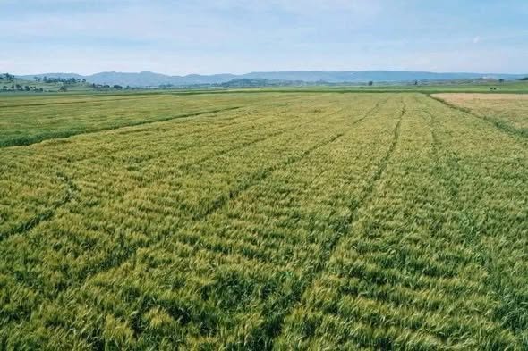
Wheat has traditionally been associated strongly with the country’s highland farming systems. Yet irrigated wheat has expanded dramatically into lowland areas, supported by varieties capable of performing under higher temperatures. What was once treated largely as a crop of particular ecological zones is becoming a crop with a much wider geographic footprint.
This is not simply an expansion of acreage.
It is a change in agricultural geography.
Land does not acquire new properties overnight. Rather, the combination of water, genetics, agronomy and infrastructure changes the practical meaning of those properties.
A hot environment can become a wheat-growing environment.
A dry season can become a production season.
A landscape historically associated primarily with livestock can acquire new possibilities for crop production where water, soil and other conditions permit.
That distinction is important in a country as ecologically diverse as Ethiopia.
From the highlands to the Rift Valley and the extensive lowlands, the country contains agricultural environments with radically different conditions. Treating all of them through one rain-fed production model inevitably leaves much of their potential unused.
The expanding irrigation effort is challenging that old logic.
Ethiopia has an estimated irrigation potential of more than 11 million hectares, according to FAO, although only a portion of that potential has historically been developed. The significance of expanding irrigation is therefore not merely that existing agricultural land becomes more productive; it is that the country gains greater freedom to decide where and when agricultural production can take place.
That freedom becomes particularly valuable as climate variability intensifies.
When rainfall is uncertain, agricultural geography becomes a moving target. A production system tied almost entirely to seasonal rain is vulnerable not only because crops may fail, but because entire areas can become economically marginal during a bad season.
Water management introduces another variable.
It allows production decisions to be made with greater control.
And once water enters the equation, other technologies become more consequential.
Improved seeds can be matched to particular environments. Mechanization can make previously difficult cultivation more viable. Fertilizer and soil-management practices can raise productivity. Digital information can help farmers make decisions about weather, planting and crop management. Roads and logistics can connect newly productive areas to markets.
One intervention reinforces another.
That is how a map begins to move.
The change is also visible in Ethiopia’s growing attention to agricultural development in lowland areas. The country has increasingly sought to bring regions long associated with pastoral livelihoods into wider productive and commercial systems, while the reality remains that not every lowland area is suitable for intensive crop agriculture and pastoralism continues to be essential to millions of livelihoods.
The point is not to replace one landscape with another.
It is to widen the range of possibilities available within each landscape.
That is a more sophisticated proposition.
Pastoral areas need not be understood only through the lens of livestock. Drylands need not be equated automatically with agricultural impossibility. Rain-fed land need not remain permanently limited to one production season. And agricultural development need not mean forcing every landscape into the same model.
The future lies in matching technology and production systems to ecological realities.
That requires science.
It requires water.
It requires better seeds.
It requires knowledge of soils and climate.
It requires infrastructure.
And it requires the ability to distinguish between land that can be transformed productively and land whose ecological and economic value lies elsewhere.
This is where Ethiopia’s agricultural transition becomes more than a story about increased output.
It becomes a story about expanding the country’s productive geography without pretending that geography no longer matters.
That distinction will become increasingly important.
The most successful agricultural systems of the future will not necessarily be those that cultivate every available hectare. They will be those that understand which hectares can produce what, under which conditions, with how much water, through which technology and for which markets.
Ethiopia is moving toward that more differentiated agricultural economy.
The implications extend beyond food production.
A newly productive agricultural area can support local employment. It can create demand for machinery and inputs. It can supply agro-processing industries. It can stimulate roads, storage and logistics. It can bring previously distant production zones into national markets.
Agricultural expansion can therefore pull other forms of infrastructure behind it.
The geography of production begins influencing the geography of investment.
And that can have a particularly powerful effect in a country where enormous differences in ecology and economic opportunity exist across relatively short distances.
The Green Legacy movement adds another dimension to this changing landscape. Ethiopia’s large-scale restoration efforts are increasingly linking tree planting, watershed protection, soil conservation and landscape rehabilitation with the longer-term productivity of land and water. The country’s 2026 campaign alone reported more than 805 million seedlings planted in a single day, with millions of participants across the country.
Restoration and production are therefore not necessarily opposing stories.
A healthier watershed can protect agricultural water.
Better soil can sustain yields.
Trees can reduce erosion and improve landscape resilience.
And degraded land, when rehabilitated appropriately, can regain productive value.
The agricultural map is consequently being redrawn in more than one direction at once.
Some boundaries are being pushed outward through irrigation and technology.
Others are being restored through ecological rehabilitation.
Still others are being redrawn through infrastructure, markets and changing patterns of rural investment.
The deeper transformation is conceptual.
For a long time, agricultural potential was often treated as though it were largely embedded in the physical landscape and therefore fixed.
Ethiopia’s recent experience suggests something different.
Potential can be developed.
Constraints can sometimes be engineered around.
Production systems can move.
The productive calendar can expand.
And land once considered peripheral to the national food economy can acquire a new role when science, water, infrastructure and investment arrive together.
This does not mean Ethiopia has conquered its agricultural constraints. Vast areas remain vulnerable to drought, floods, land degradation and inadequate infrastructure. Nor can technology erase ecological limits.
But the country is increasingly refusing to regard those limits as the entire story.
That may be the most consequential change of all.
Because once a country begins to redraw the geography of what it can produce, it is no longer simply increasing its harvest.
It is changing its map of possibility.